|
|

|
|
Home Local
History Timeline
Start |
|
Native American tribes (the Algonquin) flourish on Long Island. |
1600 |
|
European explorers arrive in the “New Land”, Henry Hudson arrives at Long Island in 1609. The Dutch settle the western end, while the British settle in the eastern regions. |
1640 |
|
Americas Colonial whaling industry begins on the shores of Long Island in the area of Southampton. Soon after, Brookhaven settlers would hunt and process whales off the shore of Fireplace (now Brookhaven Hamlet).
|
1655 |
|
Brookhaven
township is established by a small group of
English settlers and the whaling industry promotes growth. “Old Town Road”, likely a native American trail, is created to move settlers from
Setauket south through Coram and ends in FirePlace
(now Brookhaven Hamlet) just to the west of the Mastic Salt Hay fields.
|
1657 |
|
Richard Woodhull makes the first purchase of land on behalf of the town from local Native Americans. The purchase covers two necks of land on the Mastic Peninsula. |
1664 |
|
The "Old Purchase at South” was made from Tobaccos, a chief of the Unchechaug Indians, which included the western part of South Haven, Brookhaven and Bellport. This was purchased from the Indians for four coats and about $16 in cash, and the deed is still among the town papers at Patchogue. In addition to getting hay in this part of the town, men came here from the north side settlements to go whaling at an early date, as the oil could be used in their lamps and whalebone was a versatile material. –Thomas R Bayles |
1691 |
|
On May 25, 1691 Col.
William "Tangier" Smith purchased from the Indian, John Mayhew the
enormous acreage, later to be known as the Manor of St.
George. He then set aside 175 acres of the land occupied by the
Unkechaug Indians on the west side of the Mastic (Forge) River at Poosepatuck
Creek to be theirs for the annual rent of two ears of corn. The Poosepatuck
Indian Reservation is still in existence today, however it has shrunk
to 55 acres due to unscrupulous land dealings by early officials. –by Van R.
Field illushis
|
1700 |
|
By this time, the Mastic area is controlled by the aristocratic families of the name Smith, Floyd, Nicoll, and Woodhull. |
1709 |
|
The Manor House at St. George is built for William “Tangier” Smith.
|
1717 |
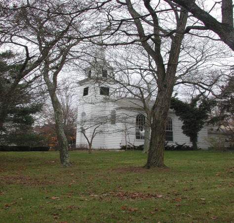
|
The Old South Haven Presbyterian Church is established and attended through the years by area residents such as the Floyds, General Nathaniel Woodhull, Judge William Smith and Colonel Josiah Smith.
|
1718 |
|
Richard Floyd ll purchases over 4400 acres of property from William Tangier Smith of the Manor of St. George. The property stretched six miles north from Moriches Bay and approximately one mile west from the Mastic or Forge River. It included use rights for the Great South Beach on what is now Fire Island. Richard Floyd II gave this property to his youngest son, Nicoll Floyd (1703-1755). |
1722 |
|
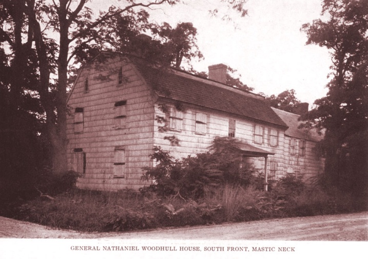
Famous Revolutionary Patriot Nathaniel Woodhull is born at the first Richard Woodhull estate, located between Hemlock and Daisy Drive on the south side of Neighborhood Road (destroyed by fire).
|
1724 |
|
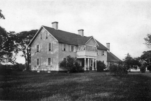
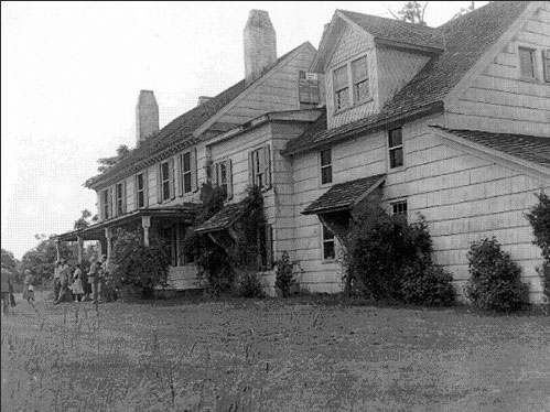
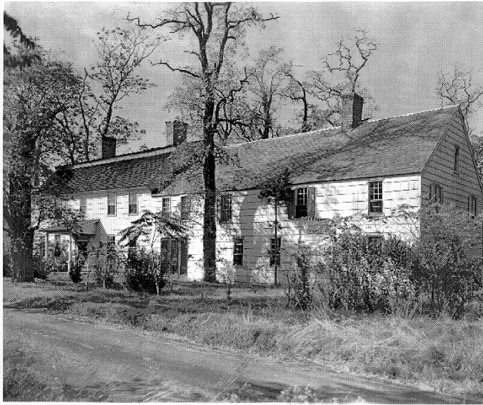
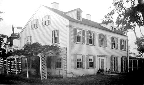
Nicoll
Floyd, Father of William Floyd, moves onto the property and builds the first
part of the estate, also referred to as “The Old Mastic House”. The original home was a two-story, six room shingled wood frame house. He developed the land into a prosperous plantation, using both slave
and free laborers to raise grain, flax, sheep, and cattle.
|
1734 |
|
William Floyd, delegate and signer of the Declaration of Independence, is born on December 17. |
1738 |
|
Construction of the first road through Mastic is complete and leads to the Manor of St. George.
|
1755 |
|
William Floyd inherits Mastic Plantation at the young age of 20 from his father, Nicoll Floyd. |
1761 |
|
Richard Floyd Mansion and property consisting of approximately 3000 acres is established.
|
1776 |
|
William Floyd, a member of the Continental Congress, signs the Declaration of Independence on August 2nd, and will not be able to return to his estate for another 7 years. The British seize his home and property after defeating the colonial army during the Battle of Long Island.
…famous
portrait of William Floyd
Nathaniel Woodhull is captured by the British and dies from his wounds after being imprisoned. He is buried at his home in Mastic.
|
1780 |
|
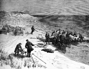
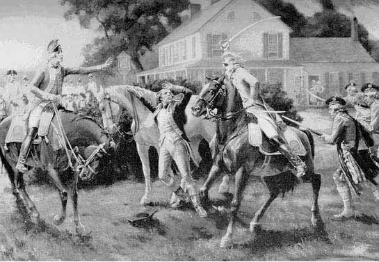
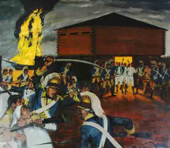
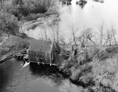
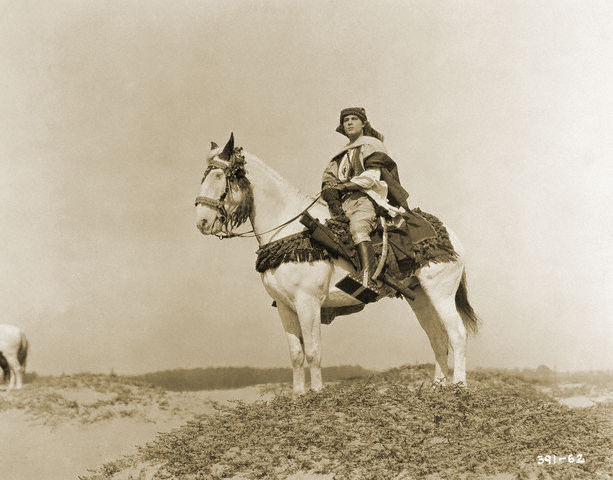
The Battle of Mastic, using whale boat warfare. On November 21, 1780, Col. Benjamin Tallmadge and his dragoons, 80 strong, rowed across the Long Island Sound under the cover of darkness from Fairfield, Connecticut to Mt. Sinai, New York. The next day they proceeded to the south shore where they captured and burned down the Manor of St. George, which the British turned into a fort, and captured the soldiers within. On their march back to Mt. Sinai, Tallmadge stopped in Coram and ordered the burning of 300 tons of hay which the British had been stockpiling for the winter. They then returned to Connecticut.
Benjamin Tallmadge, pictured with a sword, at
Fort St. George in Mastic. In 1780, Samuel Carman
Sr. bought the mills along the lower Carmans River
and later opened a store, tavern and Inn. Over the course of the next century
the Carman family became quite wealthy and influential, and, by the
mid-1800s, owned much of the land on the west side of Carmans
River. Sam Carman Jr. had 12 children; in the 1840s, one of them, Joseph
Henry, was given about 30-acres that included Squassux
Landing. -Marty
Vanlith
Samuel Carman
Homestead Carmans Mill |
1783 |
|
After suffering much damage from the British occupation, William Floyd returns to rebuild his estate. |
1784 |
|
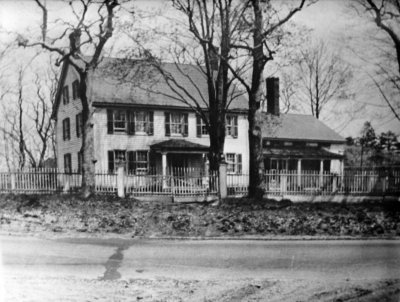
The Original Richard Woodhull Estate, believed to have been located between Hemlock and Daisy Drive in Mastic Beach, is destroyed by fire during the month of April. It would later be rebuilt by his widow Ruth Woodhull at the corner of Corn Ct. and Washington Drive in Mastic Beach.
The Richard Floyd estate, known as “Pattersquas” was conveyed by the Commission of Forfeited
Estates to Benjamin Floyd, his brother, and then eventually winds up in the
hands of William Smith, owner of the Manor of St. George |
1789 |
|
William Floyd elected to the First United States Congress (1789-1791). |
1790 |
|
Dr. Daniel Robert who had married into the Tangier Smith Family, moves into the Richard Floyd Estate and begins running the Pattersquas property. In October of 1779, Richard Floyd relocated to New Brunswick Canada as England lost the Revolutionary War. |
1791 |
|
Thomas Jefferson and James Madison, good friends of William Floyd, visit his estate. |
1803 |
|
In 1803, at age 69, William Floyd left Long Island with his family to establish a new home in Westernville, New York. Upon his death in 1821, he leaves the Mastic Property to his son Nicoll Floyd, II |
1813 |
|
The Brookhaven Township is divided into school districts for the various villages and hamlets. ..Thomas R. Bayles, History of Patchogue |
1827 |
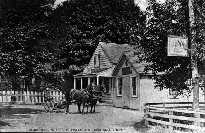
|
The Moriches Post Office was established with James M. Fanning as postmaster. Originally located in a hotel conducted by the Fannings, it would later be moved to the country store of Edmund Hallock (shown below) in 1837.
The Suffolk Club (now Southaven County
Park) is formed by Daniel Webster, Martin Van Buren and others. The property
is first leased then purchased from the Carman family and utilized as a
private hunting and fishing preserve located just north of the “goin-over” (wooden bridge over the Carmens
or Conneticut river) and running up to the area
known as Yaphank. |
1830 |
|
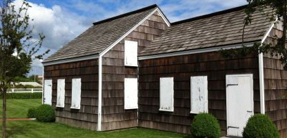
The Floyd-Murray House (aka The Petty House) is recognized as an area residence that provided shelter for Colonial age estate workers.
|
1834 |
|
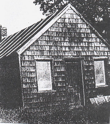
The first one room school opened in Moriches.
photo: Rita Rech |
1835 |
|
The Roberts Family, in-laws of the Smiths, take ownership of the Richard Floyd Patersquas estate with the drafting of a formal deed which is held privately and not filed until the year 1883. |
1849 |
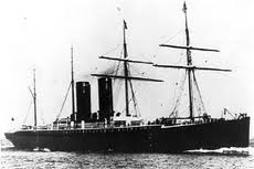
|
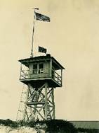
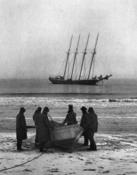
Moriches Life Saving Station established. One of three on Fire Island in this area (see entries for 1871 ad 1872). The purpose of these life saving stations were to make water rescues when ships ran aground in the surf or off shore. This station existed until 1954. The photo below is the “SS Oregon” which went down off Fire Island in 1886.
|
1862 |
|
The Great Fire of 1862 started in Smithtown, burned south to the Moriches Bay, and caused severe damage to local area property. |
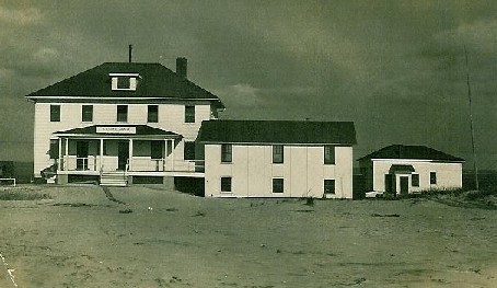
1871 |
|
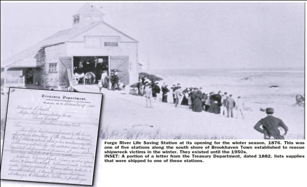
Forge River Life Saving Station established on Fire Island opposite the mouth of the Forge River. Existed until 1948. The ship the “Charlie Hickman” ran aground in 1884 ½ mile east of this life saving station. The rescues were handled by all three life saving stations.
|
1872 |
|
Smith Point Life Saving Station established on Fire Island opposite Smith Point. Existed until 1937. The photo below is the “Bessie White” which ran aground off Smith Point in 1922. The Smith Point Station was not in service at this time. The crew managed to launch life boats and were able to make it to shore.
|
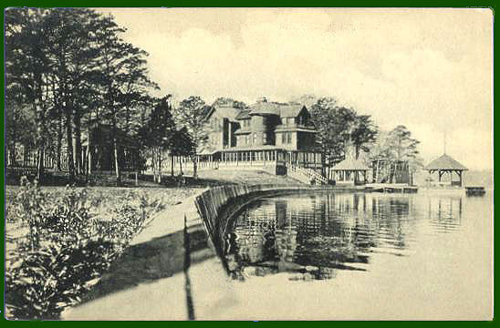
1880 |
|
The large and extravagant estate known as “Moss Lots” is built by Wiliam Buck Dana for his wife Kitty Floyd Dana. William Dana was a lawyer and instrumental in dividing up the Floyd Property, owned at the time by John G. Floyd, among his five children.
Nicoll Floyd
homestead established.
August Floyd homestead established.
|
1881 |
|
The South Side Railroad (now the LIRR) comes to Mastic with a station put in on the east side of Mastic Road. The station was moved to Shirley and the old building torn down in 1960.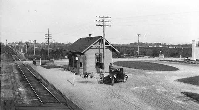
|
1896 |
|
On October 9th, Walter T. Shirley, real estate developer, is born in Brooklyn.Frank and Hannah Lawrence buy 225 acres located in Mastic Beach between Pattersquas and Odells creek, which become known as the Lawrence estate. |
1911 |
|
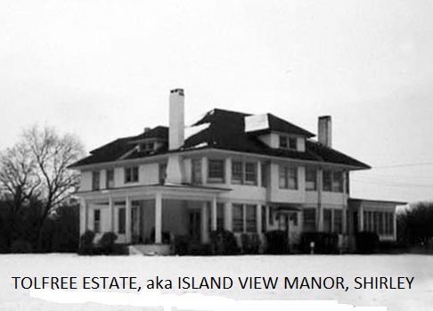
Tolfree Estate (Island View
Manor), built by Fred J. Quinby as a spec house for
his ill fated Tangier development. It was used by a Rose Quinby until the
early 1920's when the Smiths repossessed the land they sold to Quinby's Tangier Manor Corp. It was soon resold in 1922
to Edward and Aline Tolfree.
The estate was purchased by the Cutro Family after
World War Two and used as a night club where such celebrities as Tony Bennet (pictured below) would appear in the early 1950s.
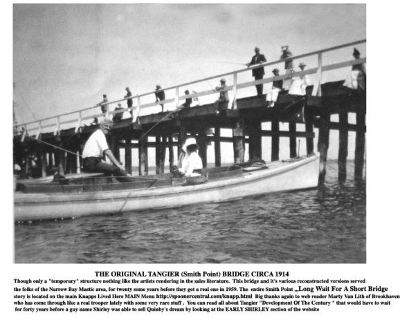
Real Estate Investor Fred Quinby has 1st wooden Tangier Bridge built to
cross from Smith Point to Fire Island.
|
1912 |
|
Author Henry Lanier purchased the Richard Floyd Estate also known as Pattersquas and “Doctors Point”. |
1916 |
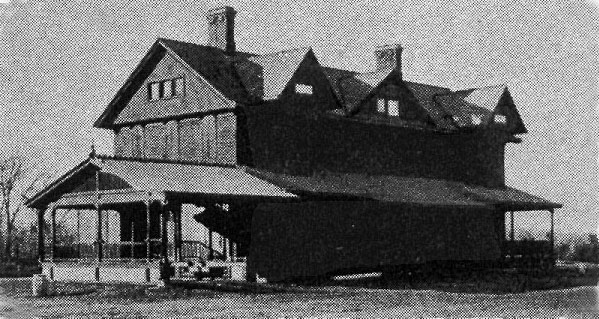
|
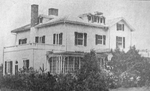
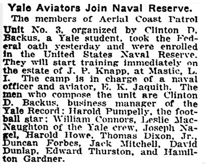
J. F. Knapp buys property from the Lawrence family that would become known as the Knapp Estate and Mansion.
|
1917 |
|
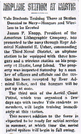
The Third Unit of the Aerial Coast Patrol was established at the Knapp Estate in Mastic (Beach).
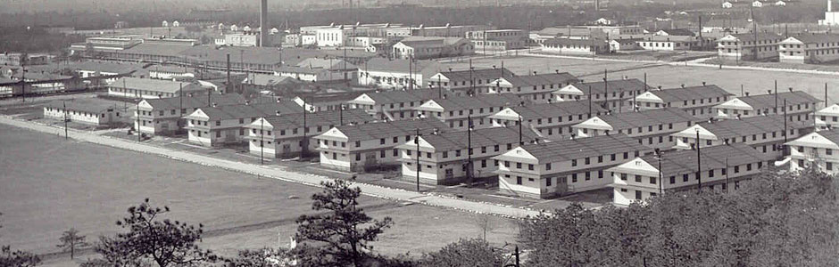
Camp Upton, pictured below, was built in 1917 as an
induction and training facility for new soldiers who were to fight in World
War I. The camp was named after Major General Emory Upton, a Union general in
the Civil War. In 1944, Camp Upton was used as a hospital to treat
wounded veterans of the war.It also served as a
Prisoner of War Camp, when in May of 1945, 500 German prisoners were sent to
Camp Upton.
|
1918 |
|
Walter T. Shirley is stationed at Camp Upton during World War I, and gets his first glimpse of the land he would later purchase and develop.
|
1918 |
|
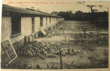
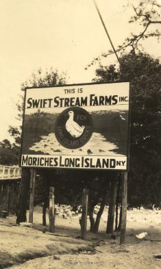
Joseph Allen Titmus and Josiah Smith Robert established the “Swift Stream Duck Farm” on both sides of the Forge River in Mastic and Moriches.
|
1919 |
|
Jurgeilewicz Family Duck farm on Barnes Road is established. |
1920 |
|
Radio broadcasting takes off and a transmitter is stationed at Radio Point in Moriches. The golden age of radio, circa the 1920s, brought an early radio station to the east end of Smith Street in East Moriches. Run by the Independent Wireless Co., the station housed a spark transmitter used to communicate with ships off shore.….newsday February 22, 1988 Anson W.
Hard purchased the outstanding shares in the Suffolk Club (now Southaven
Park) from other members, and used the property as a private estate. After WW
I, Anson's son Kenneth established a hunting and fishing lodge, known as the
Suffolk Lodge Game Preserve. It later became the first Suffolk County public
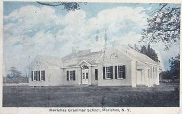
park. Moriches
Grammar School established (currently known as the Little Red School House).
|
1920’s |
|
Mastic Park from Montauk Hwy to the bay developed by Arthur and Warren Smedback and the Brooklyn Citizen.
|
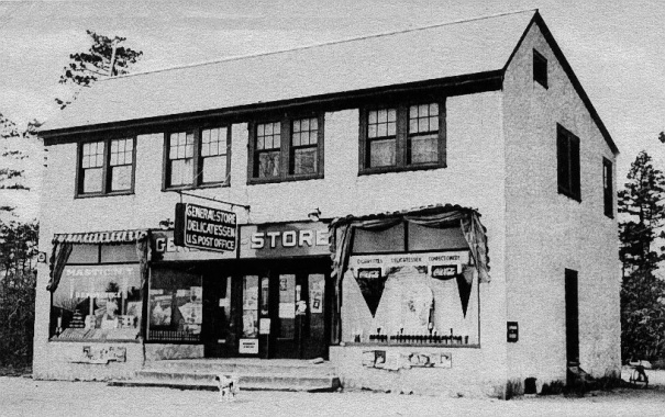
1920’s |
|
Mastic Park General Store & Post Office is built. The business would later be called McCleans Market in the 50s and 60s.
Smith Point Beach used
for several desert films. Desert
movies were made wildly popular in the 1920's by Rudolf Valentino's portrayal
of The Sheik (1921) & sequel Son Of The Sheik
(1926). The 1910 bridge's construction that allowed cameras, camels and crew
to cross the narrow bay, was supervised by local resident Michael Gillispie of Tangier (now Shirley) for Quinby's Tangier Development Company. According to
historian Van Field, it was mainly the movie companies who kept repairing the
bridge when it would get torn up by winter ice. ..Ken Spooner
|
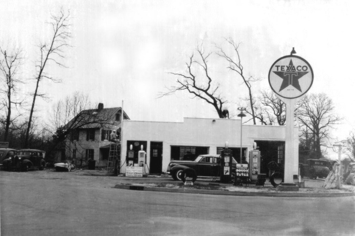
1922 |
|
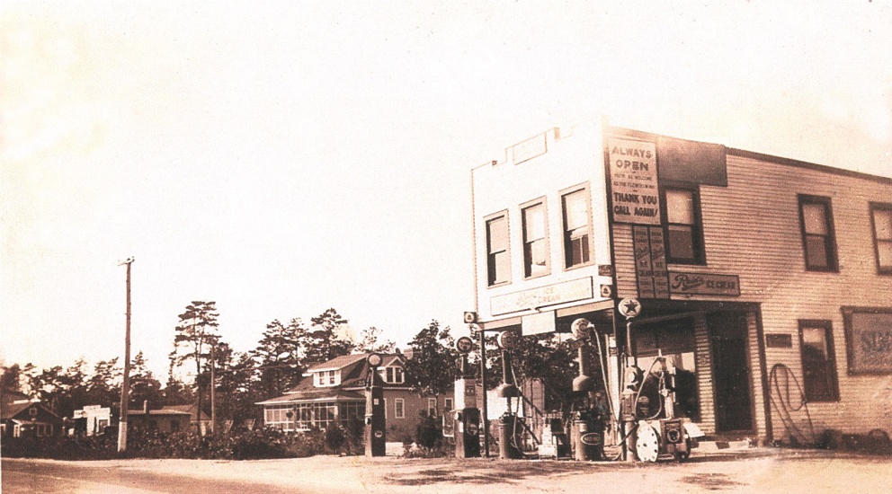
Texaco Gas Station owned by Lewis Parr opens (now Mastic Liquors).
|
1925 |
|
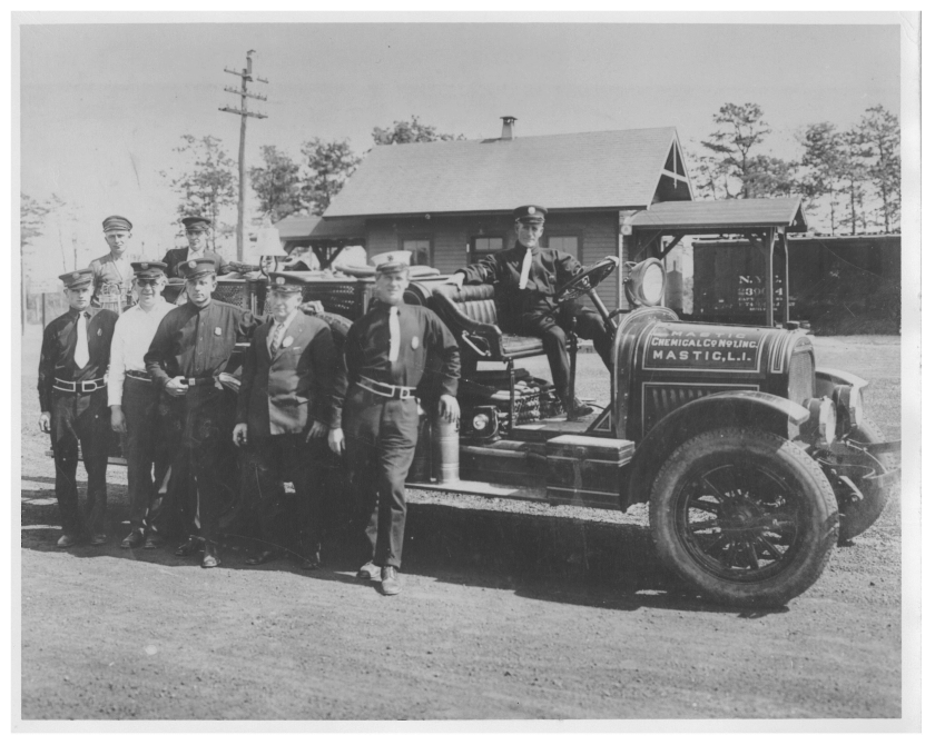
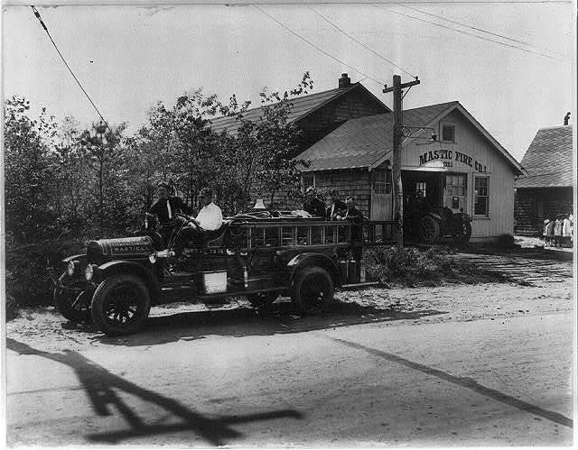
Mastic Fire Department established. It was organized by Russell Ferrer, Anthony Tebbens, Harold Lukert, Joseph Titmus and Thomas Eyton-Jones (1st Chief, in photo in white hat).
|
1926 |
|
Brooklyn Citizen purchases the J.B. Lawrence estate and it’s subdivided into lots for sale to the public. |
1927 |
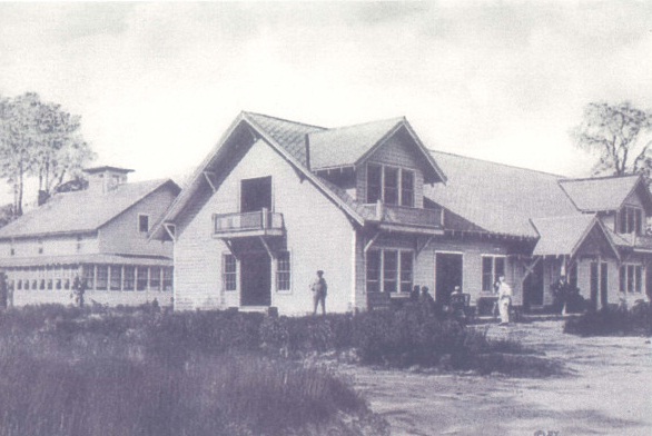
|
Mastic Beach Property Owners Clubhouse was built by Arthur Tebbins.
The 15 room Mastic Beach Hotel is
built just behind the Clubhouse by Paul Schulte.
The Smadbeck
Brothers purchase the Pattersquas estate and
property from Josephine Lanier. Tangier Bridge destroyed by Ice flows.
|
1930 |
|
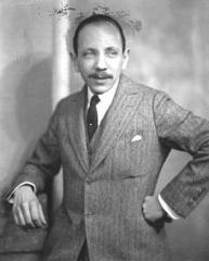
Home Guardian sells the Pattersquas Mansion to Playwright John Howard Lawson.1930 The
Lane Cemetery was located on the north side of Montauk Highway at Titmus Dr. in Mastic. Daniel Lane (1801-1865) had a large
farm at that location and had a family cemetery located there. Daniel had 10
children. Members of the family and others were buried in the Lane Family
Cemetery. In the early 1930’s, the tombstones in the cemetery were moved to
the Mount Pleasant Cemetery in East Moriches. The exact spot where the Lane
Cemetery was located is still being investigated.
|
1933 |
|
Paul Schulte’s Tavern opens with the end of prohibition and is situated along side his corner market. The tavern itself is a converted barn from the Knapp estate.
|
1935 |
|
Mastic Beach Fire Department is established, and headed by Jules Jacobs.
|
1936 |
|
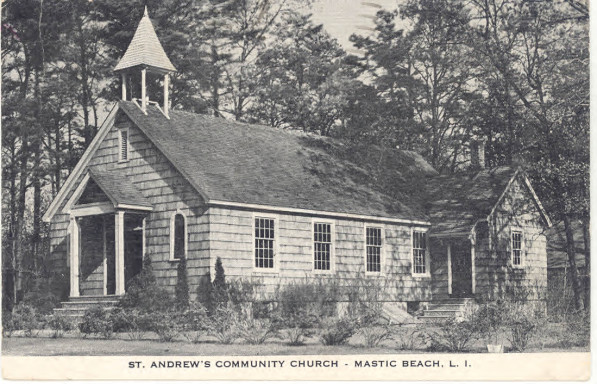
St. Andrew’s Church is established in Mastic Beach.
|
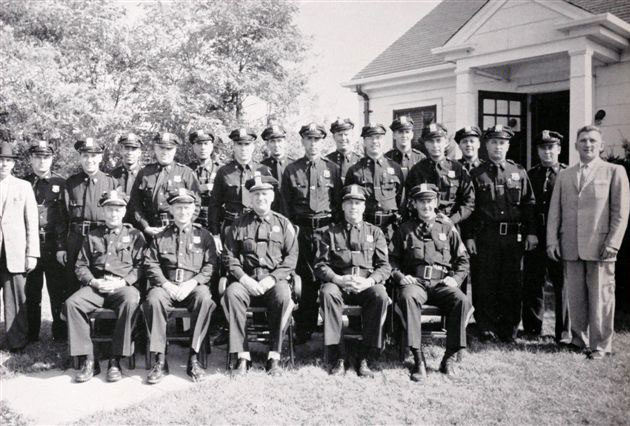
1937 |
|
Brookhaven Town Police established with a 4th precinct office located in Center Moriches. Their service ended in 1959 with the establishment of the Suffolk County Police Department in 1960.
|
1938 |
|
The 2nd General Woodhull homestead is torn down on Memorial Day by Willie Schluder. Some of the wood would be used in construction of a home in the Hamptons.
|
1938 |
|
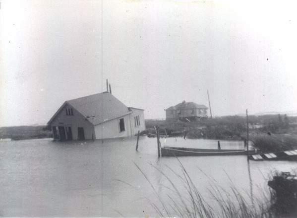
The hurricane of 1938 causes massive flooding and destruction to the Mastic-Shirley area. |
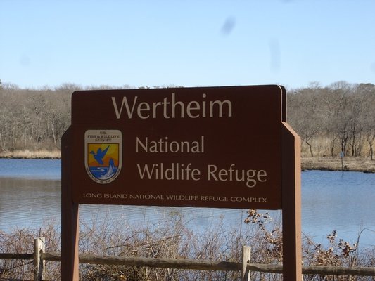
1938 |
|
Successful Investment Banker Maurice Wertheim purchases 1800 acres of property straddling the Carmens river as a private hunting reserve and for waterfowl conservation. He calls the property Stealaway. (now known as the Wertheim National Wildlife Refuge).
|
1938 |
|
J.F. Knapp sells his estate to Home Guardian thereby allowing Neighborhood Road to connect the East and West parts of Mastic Beach. The sections sold by Knapp would be listed as 9 and 10. …Ken Spooner |
1940 |
|
Mastic
Beach Property Owners Association (MBPOA) established on July 30th.
A deed was filed between the Home Guardian Company and the MBPOA for the sum
of $1. The MBPOA assumed all the public land held by the Home Guardian
Company. |
1941 |
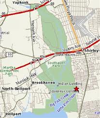
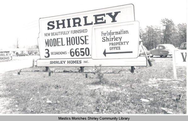
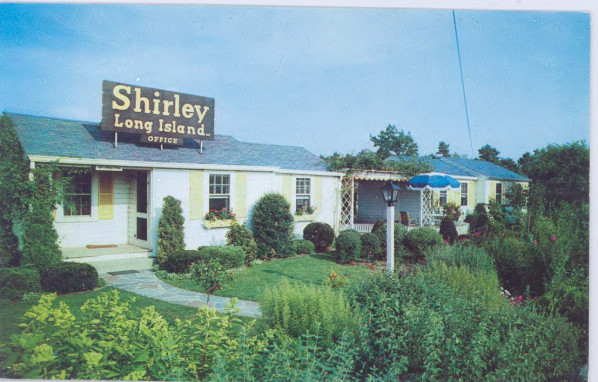
|
The area of Shirley is divided into quarter acre plots and sold as summer retreats for the working classes of New York City. Mastic Beach already has over 1000 property owners and a summer population of more than 4000 residents. By 1950, Walter T. Shirley had owned more than 1000 acres of property and the area was known as Mastic Acres. |
1944 |
|
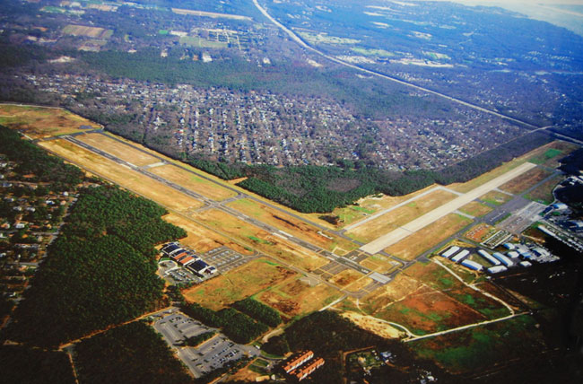
Mastic Flight Strip (now Brookhaven-Collabro Airport) built to provide logistical support for U.S. Army Corp. Title of the airport was transferred to New York State after the war. In 1961 the airport was acquired by the Town of Brookhaven. It was later renamed in honor of Dr. Frank Calabro, an important figure in the airport's development.
|
1945 |
|
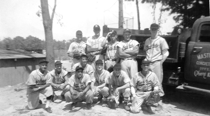
Mastic Athletic Club (aka Macs) The
first organized baseball club in the Mastics. Founded by
Ernest Stanzoni (kneeling on left). The team
played in The Western Suffolk Baseball League. (note:
Carl Yazstremski played in that league before going
on to the Boston Red Sox. Many others went on to play in the minor leagues.)
|
1946 |
|
First meeting of the Mastic Beach American Legion. |
1946 |
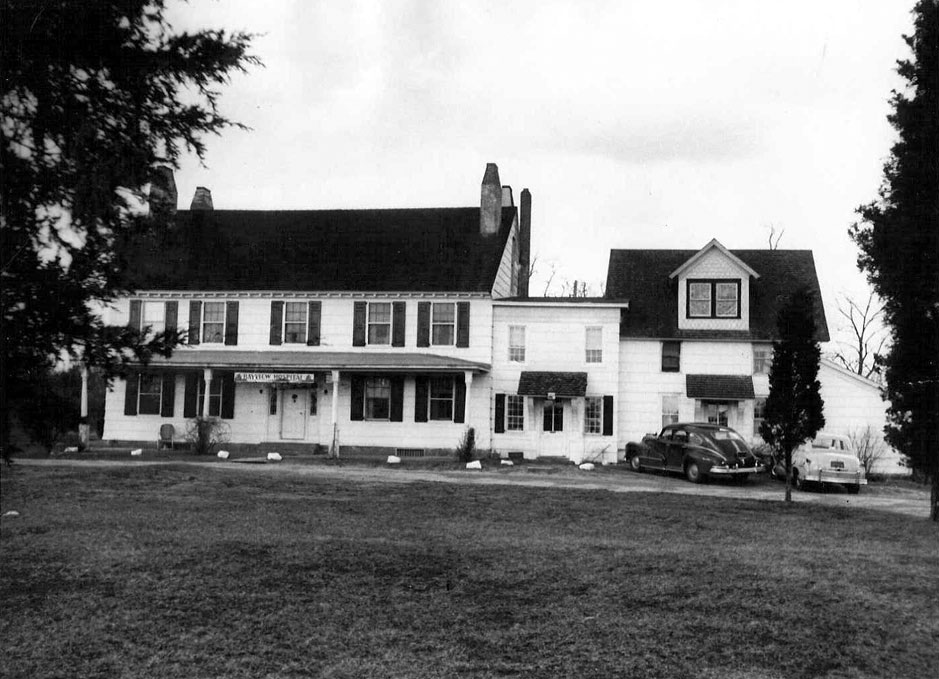
|
Dr. Frank Calabro purchases the Pattersquash Estate Mansion (original estate of Richard Floyd) and turns it into the Bayview Hospital.
|
1946 |
|
Pat Messinetti and Mike Dipierro’s Texaco gas station built at five corners intersection in Mastic Beach.
|
1947 |
|
Maurice Wertheim donates approximately 2000 acres to the U.S. Fish and Wildlife Service. The property becomes the Wertheim National Wildlife Refuge.
|
1949 |
|
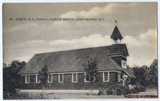
St. Jude’s Roman Catholic Church is established in Mastic Beach.
|
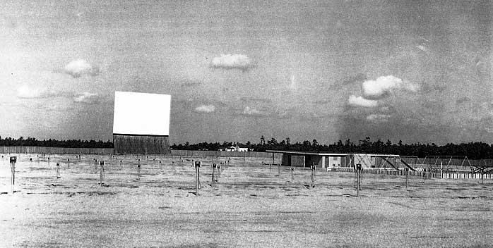
1953 |
|
Shirley Drive-In (pictured below) opens. It was located at the commercial property now called SouthPort shopping center. Prior to the development of the Drive-In by Walter T. Shirley, it was used to train horses and had a track and stables.
|
1956 |
|
Mastic Beach Hebrew Center established. |
1958 |
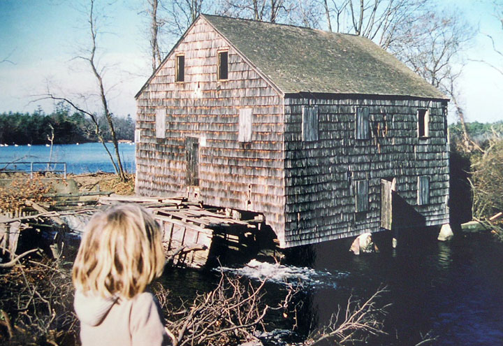
|
Carman’s Mill torn down to make way for the Sunrise Highway extension. Located just below the mill pond at Southaven Park.
|
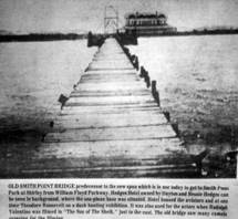
1959 |
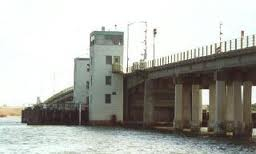
|
The Knapp Mansion burns to the ground in February of that year.Smith Point Bridge officially opened
on July 4th.
|
1960 |
|
On January 1st the new Suffolk County Police Department was formed and
covered the 6 western townships of Suffolk County including the Town of
Brookhaven. Police protection in this area went from the Brookhaven Town
Police to the new Suffolk County Police Department. Officers of the town
police were absorbed into the county police.
|
1964 |
|
Smith Point County Park opens on Fire Island.Fire Island National Seashore was
established as a unit of the National Park Service on September 11, 1964. Fire Island National Seashore (FINS)
is a United States National Seashore that protects a 26-mile section of Fire
Island, an approximately 30-mile long barrier island separated from Long
Island by the Great South Bay. The island is part of New York State's Suffolk
County |
1965 |
|
The William Floyd Estate, which was authorized as an addition to Fire Island National Seashore in 1965, is located on the mainland of Long Island in Mastic Beach, New York. The estate contains the ancestral house, grounds, and cemetery of the William Floyd family. William Floyd, a Revolutionary War general and a signer of the Declaration of Independence, was born in the house in 1734. In 1977, the Floyd family donated the contents of the house to the National Park Service, and transferred the remainder of the property to the National Park Service in 1991. |
1969 |
|
Moss Lots,
a large and extravagant home on the Dana Estate property, now called Old
Mastic, burns to the ground on September 5th. |
1974 |
|
The Mastic-Moriches-Shirley Community Library is established.
|
1980 |
|
Old Mastic receives Historic District designation from the Town of Brookhaven. |
1996 |
|
On July 17th, at approximately 8:45pm, TWA Flight 800 explodes over the Atlantic a few miles off the coast of the Moriches Bay communities.
|
1999 |
|
Mastic Peninsula Historical Society founded by Rita Rech with the help of Edward Romaine.
|
2010 |
|
Mastic Beach becomes an Incorporated village.Montauk Highway Project. In April a project to enhance traffic flow, reduce gridlock and improve safety along a nearly two-mile stretch of Montauk Highway in Shirley and Mastic was started. The project ran from Wm. Floyd Pky. in Shirley to east of Mastic Rd. in Mastic. New curbs and sidewalks on both sides of the roadway were part of the project and trees were also planted along the entire length. The project took almost two years to complete. |
2011 |
|
Jurgeilewicz Duck Farm closes August of 2011, the last of what was once a strong and thriving industry for the area.Tropical Storm Irene travels over Long Island on August 29th
and causes major wind and flood damage to the tri-hamlet area.
|
2012 |
|
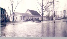
Floyd-Murray House receives historic landmark status from the Town of Brookhaven.Tropical Storm Sandy causes major
flood damage and destruction to area residents. |
2013 |
|
Wood from General Woodhull’s home which was sent to the Hamptons (see 1938 entry) was returned to the Village of Mastic Beach to be reused in a visitor’s center. |


Credits:
Copywrite 2013 by the Mastic Peninsula Historical
Society
Design by:
Brad Shupe, MMSCL*/MPHS**
Compilation by:
Brad Shupe, MMSCL/MPHS
Richard Oldham, MPHS
* Mastics Moriches Shirley Community Library
** Mastic Peninsula Historical Society
Special Thanks to the
following people/organizations:
·
Ken
Spooner
·
Marty Van
Lith
·
Southaven
Historical Society
·
Mastics –
Moriches – Shirley Community Library
·
Suffolk
County Historical Society
·
Brookhaven
Free Library
Disclaimer:
All content provided on this Community
Timeline page is for informational purposes only. The Mastic Peninsula
Historical Society will not be liable for any errors or omissions in this
information nor for the availability of this information. The MPHS will not be
liable for any losses, injuries, or damages from the display or use of this
information. These terms and conditions are subject to change
at any time with
or without notice.